
PROJECT ARGUS
Autonomous Aerial Security and Conservation Intelligence
Named after Argus Panoptes—the all-seeing, hundred-eyed sentinel of Greek mythology—Project ARGUS (Autonomous Response and Ground Unit Support) is an autonomous aerial security and conservation platform. ARGUS fuses ground sensors, AI-enabled wildlife collars, and a docked beyond-visual-line-of-sight (BVLOS) drone into a single, always-on protective layer for endangered species and critical conservation assets.
ARGUS is both an acronym and an operational metaphor. As an acronym, it describes the project’s core function: Autonomous Response and Ground Unit Support. As a metaphor, it delivers an “all-seeing guardian” network where ground-based sensors, animal biometrics, and aerial assets work in unison. When a sensor detects a potential threat, ARGUS provides rapid “eyes in the sky” to investigate in real time—turning the UAV into an intelligent, roving camera trap that can be dispatched on demand.
What is Project ARGUS?
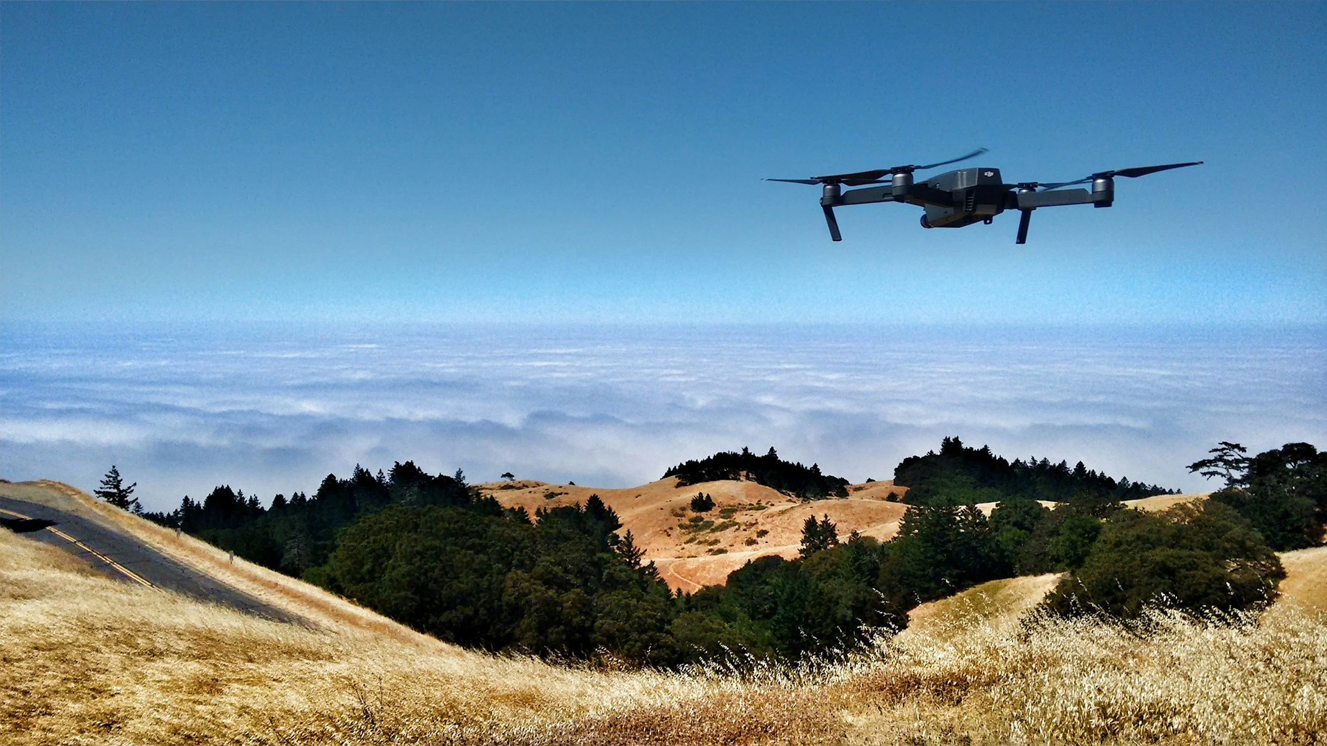
At its core, ARGUS is a “drone-in-a-box” system designed for persistent, on-site readiness. A DJI Dock 3 and DJI Matrice 4TD aircraft function as a fully autonomous forward operating base that can launch, fly, land, and recharge without on-site human presence.
ARGUS integrates multiple data streams into one operational picture, including:
AI camera traps and wpsWatch alerts
EarthRanger via Gundi
AI-enabled wildlife collars and biometrics
Perimeter and field sensors
Mission & Vision – The Silent Shield
Project ARGUS is designed to be the reserve’s “Silent Shield”: a standard of excellence in autonomous observation that protects wildlife through unyielding vigilance, technological precision, and ethical stewardship of the ecosystem.
Why AI-enabled DRONE intelligence matters
In conservation operations, speed and clarity are the difference between a verified incident and uncertainty. ARGUS compresses the detect-to-deploy timeline by combining ground-based detection with airborne AI-assisted verification—helping teams respond quickly while reducing false alarms and unnecessary deployments.
AI also strengthens conservation science by making monitoring more frequent, consistent, and non-invasive. ARGUS supports high-frequency aerial observation and thermal sensing to improve the way teams measure:
Wildlife distribution and movement
Habitat condition and change over time
Hotspots of activity and ecological patterns
Hard-to-detect animals in dense vegetation (including with thermal imaging)
ARGUS is guided by four operational principles:
Vigilance Without Intrusion: “Sees everything, disturbs nothing.” Missions are designed around animal behavior to minimize disturbance.
Safety Is Binary: Operations are either safe or they are grounded—supported by strict BVLOS protocols and a human Remote Pilot in Command with authority to stop flights immediately.
Speed Is Survival: Engineering decisions prioritize rapid response when an alert is triggered.
Data Is Truth & Justice: Footage and telemetry are treated as digital evidence—timestamped, geolocated, and handled with chain-of-custody discipline.
What ARGUS helps teams do
Project ARGUS supports security, science, and capacity-building objectives by enabling teams to:
Verify alerts rapidly from the air when sensors detect potential threats (fence breaches, AI camera detections, wildlife collar distress)
Reduce false call-outs for ground units by confirming incidents before dispatch
Provide live overwatch to improve ranger safety and situational awareness before contact
Conduct scheduled aerial patrols over perimeter lines and hotspots, with routes that can be adjusted and kept unpredictable
Run night operations with thermal intelligence to detect human and vehicle heat signatures in low-light conditions
Replace sporadic manual surveys with high-frequency, non-invasive ecological monitoring
Generate conservation science insights such as wildlife population estimation, herd movement tracking, and habitat health assessment
Support ecotourism planning through early scouting missions that reduce unnecessary driving and improve wildlife viewing outcomes
Build local operational maturity by transitioning from vendor-led deployments to an in-house capability, aligned with South African aviation requirements (SACAA Part 101) and BVLOS approvals
KEY capabilities
AI-enabled analysis and decision support
ARGUS integrates AI across detection, verification, and monitoring:
wpsWatch AI continuously analyzes imagery and sensor data to trigger actionable alerts
AI-enabled wildlife collars and biometrics support behavior monitoring, flagging abnormal movement patterns that may indicate distress, injury, or high-risk events
Onboard and custom AI capabilities support subject tracking and persistent visual contact on suspicious activity—helping operators manage a broader tactical picture with clearer, faster insight
Operational intelligence that supports real-world workflows
ARGUS is designed to operate as a persistent, autonomous platform:
A DJI Dock 3 / Matrice 4TD system enables automated launch, landing, charging, and repeat missions without on-site human presence
FlytBase orchestrates scheduled patrols and rapid response missions, enabling the UAV to launch dynamically based on incoming alerts
A static dock creates major operational advantages over “drive and fly” teams:
Near-zero launch latency (seconds instead of long travel time)
BVLOS reach (response dictated by airspeed, not road conditions)
24/7 persistence through land–recharge–relaunch cycles
A hardened dock concept built for high availability in demanding field conditions
Stronger coordination across teams and partners
ARGUS is built as a system-of-systems where data and response workflows align across platforms and teams:
Sensor and collar alerts can route into aerial tasking workflows
Aerial verification reduces uncertainty before teams commit resources
Integrations across wpsWatch, EarthRanger via Gundi, and field sensors support shared situational awareness between operators and on-the-ground teams
Prevention-first conservation outcomes
ARGUS shifts conservation from reactive response to proactive protection by:
Deterring threats through persistent, rapid verification capability
Reducing the risk of ambush and unnecessary exposure for ground teams
Increasing the efficiency of patrols by focusing resources on confirmed incidents
Expanding the volume and quality of ecological monitoring—without increasing field disturbance
Who Project ARGUS is for
Project ARGUS is designed for reserves and conservation partners who need scalable, aviation-grade capability across both protection and monitoring, including:
Rhino and other high-value species landscapes needing rapid aerial verification
Protected areas with perimeter security challenges and large patrol areas
Conservation science teams seeking high-frequency, non-invasive aerial monitoring
Operations rooms and ranger units that benefit from real-time overwatch and coordinated response
Partner reserves looking to build local capacity and long-term, in-house autonomy
Results that matter: speed, safety, and better science
ARGUS is designed to deliver measurable outcomes across security and conservation science, including:
Faster verification of alerts with an operational goal of under 3 minutes to “eyes on target” within a 5 km radius of the dock
Reduced false call-outs, saving ranger time, vehicles, and fuel while improving safety and decision confidence
Increased monitoring frequency and survey coverage for ecological intelligence and adaptive management
Clearer, evidence-grade data capture through geolocated, timestamped imagery and telemetry
Sustainable, locally operated capability that strengthens long-term implementation and ownership
Get started with Project ARGUS
Project ARGUS is a deployable, integrated platform for reserves and partners looking to combine autonomous drone operations, AI-enabled detection, BVLOS aerial response, and conservation science monitoring into a single always-on protective layer.
Contact us to explore deployment requirements, operational design, integration with wpsWatch/EarthRanger/Gundi, and how ARGUS can be adapted to your landscape, species priorities, and conservation goals.